New York City Street Map Print Vintage Poster Old Map as Art
Couldn't load pickup availability
Details
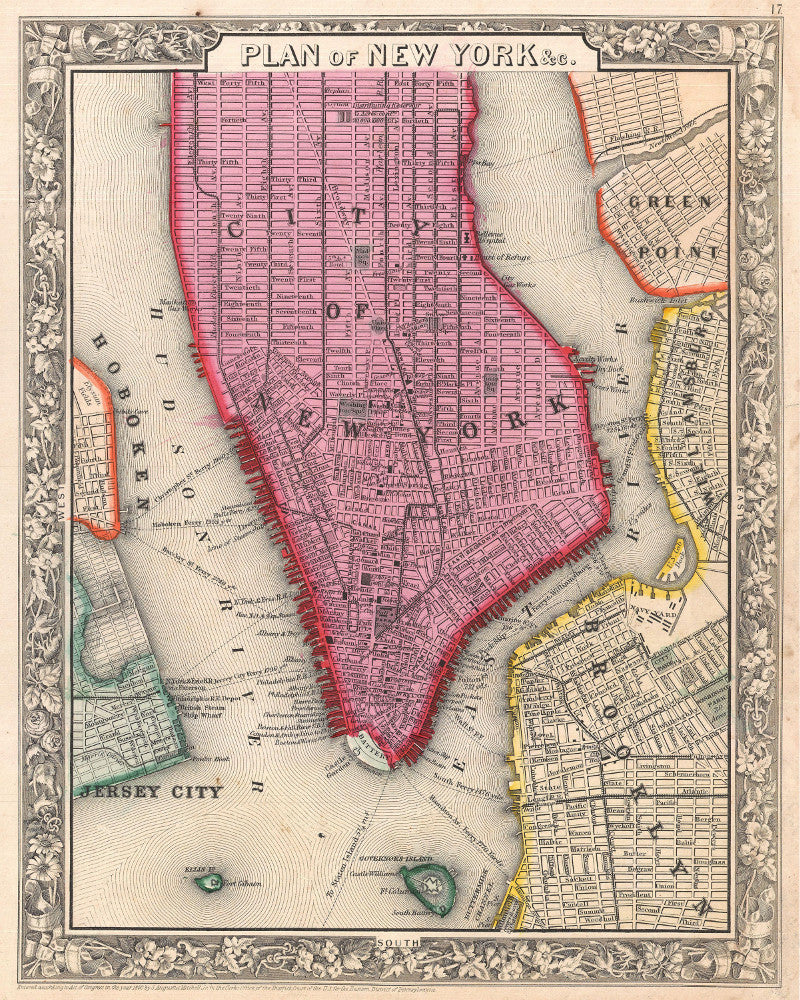
1860 Mitchell Map of New York City, New York (first edition)
A beautiful example of the first edition of S. A. Mitchell’s 1860 map of New York City. Depicts New York City along with parts of Brooklyn, Williamsburg, Greenpoint, Hoboken and Jersey City. Offers wonderful detail at the street level including references to parks, individual streets, piers, ferries, and important buildings. Colored coded with pastels according to towns. Surrounded by the attractive floral border common to Mitchell atlases between 1860 and 1865. This variant differs from later examples (1861-2) of Mitchell’s New York in that city wards are not defined. One of the more attractive atlas maps of New York to appear in the mid 19th century. Prepared by S. A. Mitchell Jr. for inclusion as plate 16 in the 1860 issue of Mitchell’s New General Atlas . Dated and copyrighted, “Entered according to Act of Congress in the Year 1860 by S. Augustus Mitchell Jr. in the Clerk’s Office of the District Court of the U.S. for the Eastern District of Pennsylvania.
Some aging and marks on the original maps have been left to add character to the print.
Samuel Augustus Mitchell - American Geographer
Mitchell worked as a teacher before turning to publishing geography textbooks and maps. He became involved in geography after teaching and realizing that there were so many poor quality geographical resources available to teachers. He moved to Philadelphia, Pennsylvania in either 1829 or 1830. He was in Philadelphia when he founded his company. His son, S. Augustus Mitchell, became owner in 1860. Their publications covered all genres of geography: maps, travel guides, textbooks, and more. Sales of his 24 works reached an annual volume of over 400,000 copies.
All prints are made using archival art stocks and UV pigment inks to give up to 200 years life. Prints are sold unframed and unmounted.


